News
27.01.2026
Scan and Plan Your Journey with NFC Stickers
How can you quickly check a timetable, find the nearest bus or trolleybus connection, or plan a journey using public transport? In Gdynia, special stickers with NFC tags have appeared in public spaces, enabling faster access to passenger information. The initiative is implemented as part of the EU-funded project SPINE (Smart Public Transport Initiatives for Climate-Neutral Cities in Europe), financed under the Horizon Europe programme.
Quick access to timetables
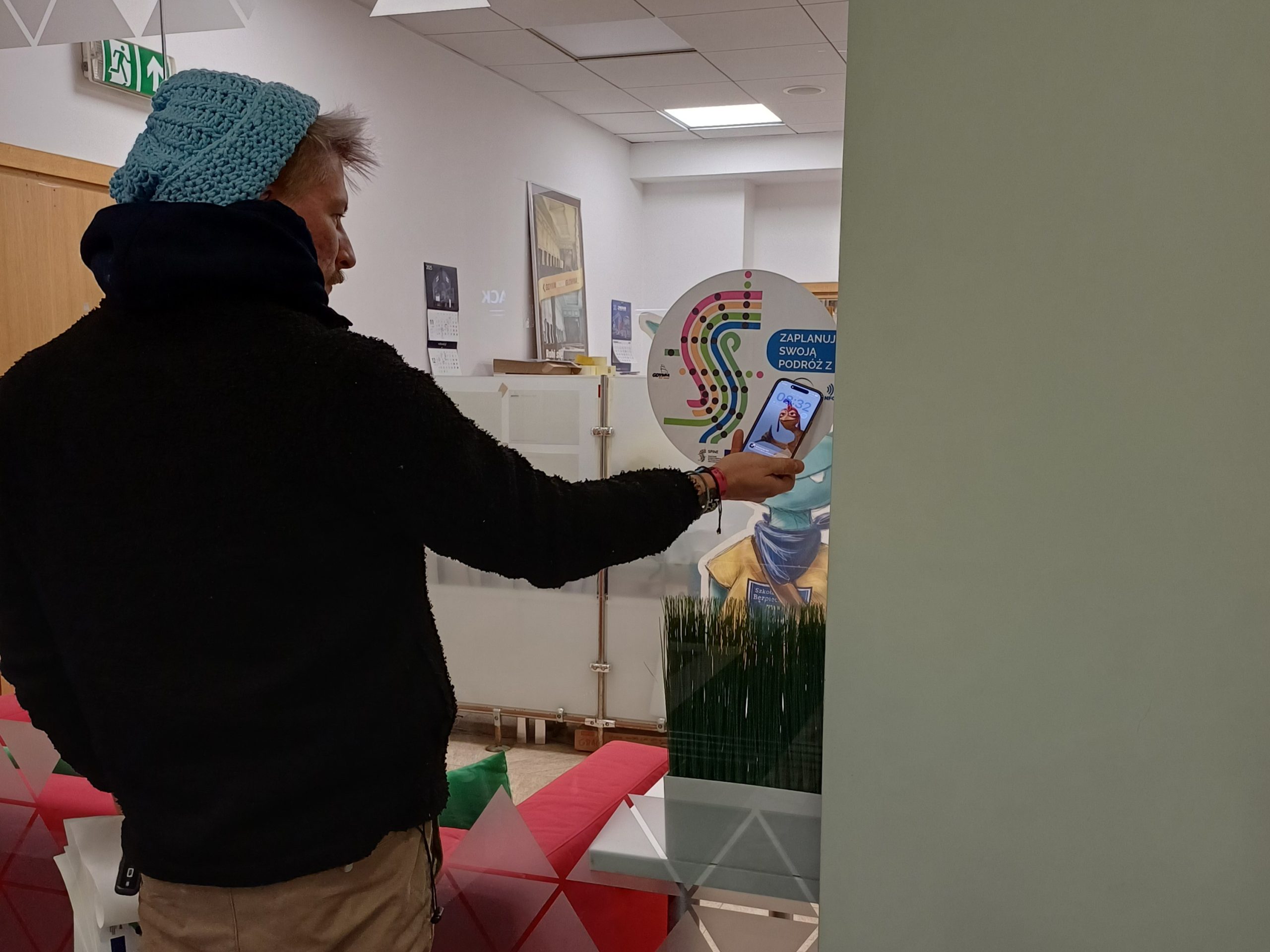
Access to passenger information has a real impact on residents’ everyday transport choices. That is why one of the elements of the information campaign carried out in public spaces as part of the SPINE project is NFC-tagged stickers that link directly to the official Public Transport Authority website with all the useful news on travelling by public transport. By simply holding a smartphone close to the sticker—without installing any additional applications—users can:
- check the current timetable,
- search for the nearest public transport connections,
- plan further journeys based on up-to-date connections and travel times,
- check current departure times and any service changes.
The stickers complement existing passenger information at stops and are particularly useful in locations where stop infrastructure is not directly available, such as public buildings or service and commercial spaces.
The NFC stickers are already available in public spaces throughout Gdynia for all residents, regardless of age, experience in using public transport, or length of residence in the city. As part of the campaign, 100 stickers have been installed in public areas.
Where can you find the markings?
The stickers take the form of circular posters with a diameter of 30 cm. They have been placed, among others, in:
- public administration buildings,
- cultural and recreational facilities,
- healthcare clinics,
- educational institutions,
- other publicly accessible facilities across Gdynia.
Each location was agreed with the building owner or manager, and the stickers themselves are easy to locate if the display location changes. From a passenger’s perspective, this means that public transport information is available exactly where travel decisions are often made: at building exits, in service areas, during visits to public offices, cultural and recreational spots. It is a simple solution that makes it easier for residents to quickly check available connections and always remember the easy alternative.